 | ||
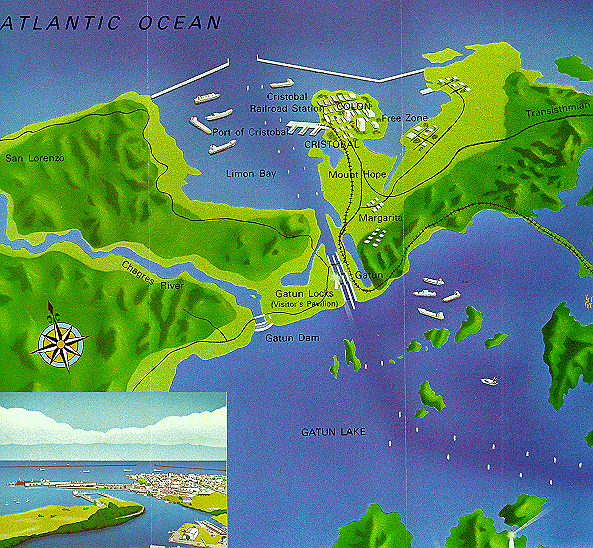 | ||
From the Canal Commission's official 1997 map, this is a representation of the Atlantic end of Gatun Lake and the Gatun Locks which lead into Limon Bay and, finally, the Atlantic. | ||
At the end of the Culebra Cut, the ship reaches Gamboa, the site of the Chagres River, and the headquarters for dredging operations on the Canal. The ship now sails into Gatun Lake, a large and beautiful artificial lake with islands which were once mountaintops. Most striking are the sightings of the tops of trees, now bare of leaf, sticking out of the water. They are just the last visible remnants of the jungle which existed before the river was dammed and the lake was created. We were told that several towns were also buried under the waters of Gatun Lake. The ship follows a clear channel through the lake, the path that the Chagres took before it was dammed. And then, looming ahead, are the great Gatun Locks, three locks which would lower the ship to the Atlantic. | ||
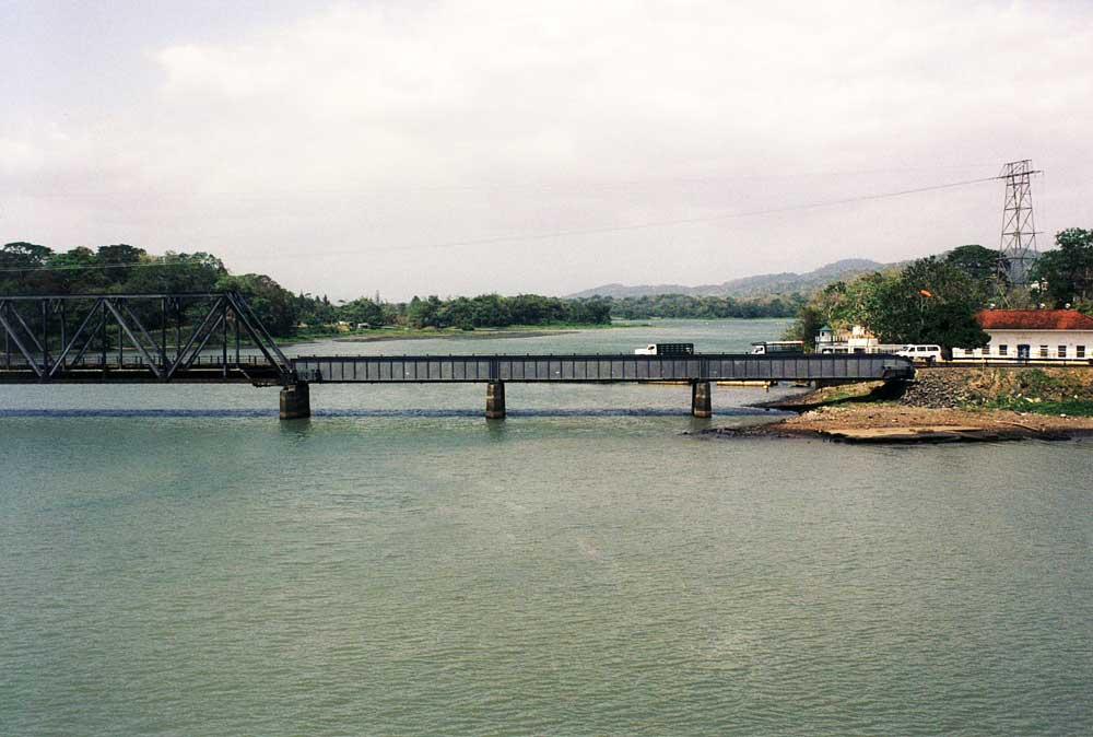 | ||
This is the Chagres River at Gamboa. It was this river, among other things, that stymied Ferdinand deLesseps in the late 1870's. And it was this river that the Americans dammed to create the immense artificial Gatun Lake. | ||
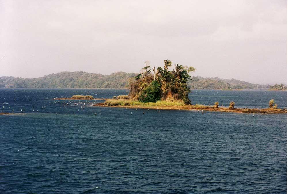 | ||
In Gatun Lake, what were once mountain tops are now islands. And the tops of rather tall trees continue to stick out of the water, even after all these years. | ||
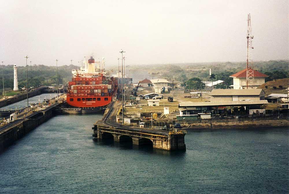 | ||
After almost a full day of being in the Canal, we have finally reached the Gatun Locks where the ship will be lowered down to the level of the Atlantic Ocean. | ||
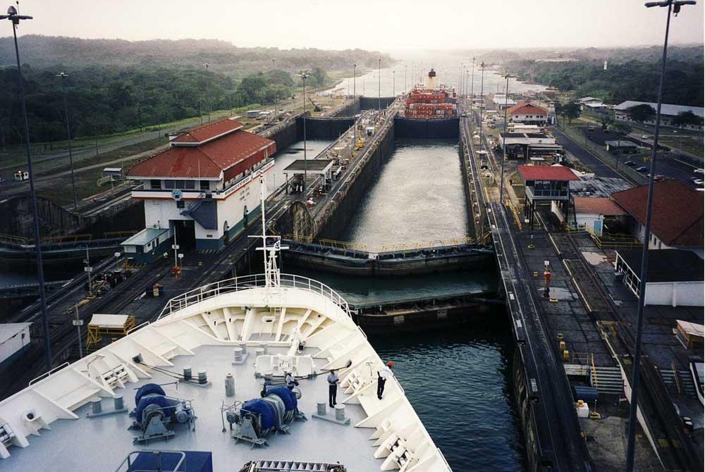 | ||
By the end of the day, other passengers had tired of the Canal, and I had no one in my way as I took shots of the entry into the Gatun Locks. | ||
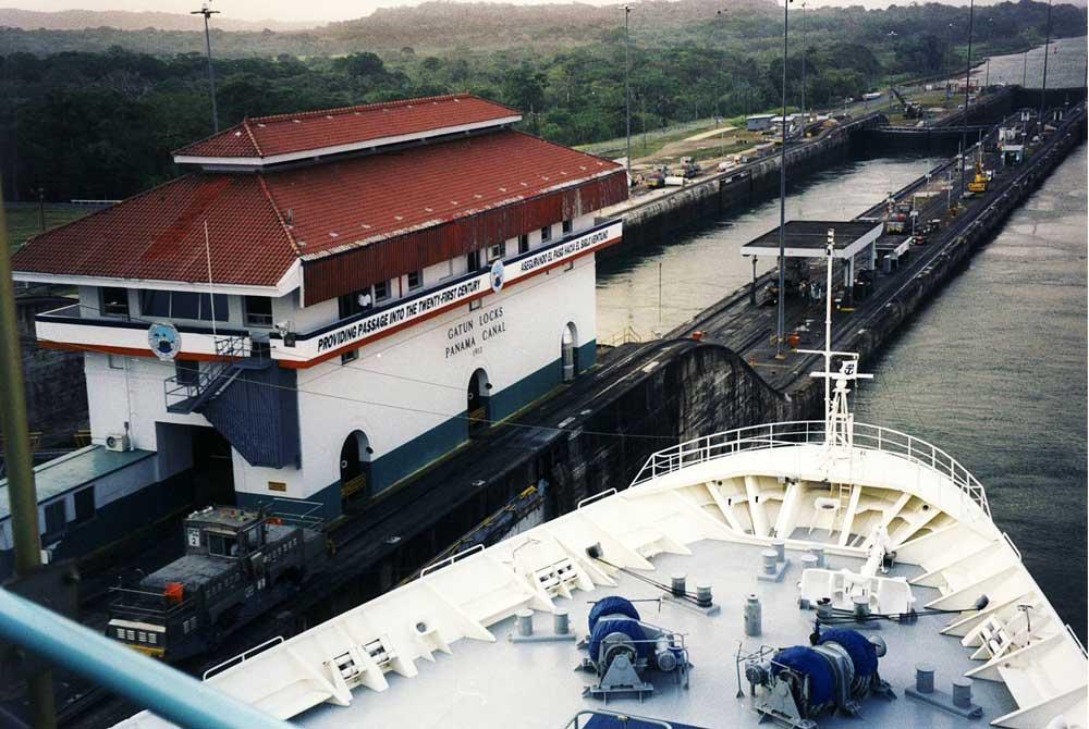 | ||
The Gatun Locks building. The Panama Canal Commission's slogan: "Providing Passage Into the Twenty-First Century." Panama was soon to take full control of the Canal from the United States. The trip through the Canal took approximately 10 hours. | ||
Curacao We arrived in Curacao, Netherlands Antilles, on Saturday, March 28. We had signed up for an excursion tour of the island and we were soon off in our bus to take the tour. First reaction: disappointment. Not only were the plastic windows of the bus scratched up so that it was difficult to see the sights, but the island was clearly extremely arid and particularly so due to the lack of rain (almost none over the previous year). We were taken to bat caves and a museum, something most of us really didn't care about and at long last found ourselves dropped in downtown Willemstad, a Dutch city, with a colorful waterfront made to look somewhat like Amsterdam. The afternoon was spent walking around the town which included an outside view of the oldest Synagogue in the western hemisphere (even older than that at Newport, RI). Unfortunately, since it was Saturday, we couldn't go inside. Willemstad has loads of tourist shops selling the usual watches, jewels, liquor, and T shirts. There was a pontoon bridge over to the ship's side with about a 20 minute walk past more shops to return to the ship. | ||
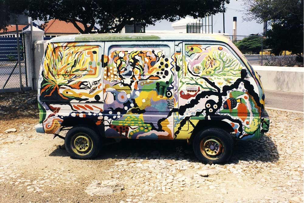 | ||
Lots of colorful objects in Curacao. | ||
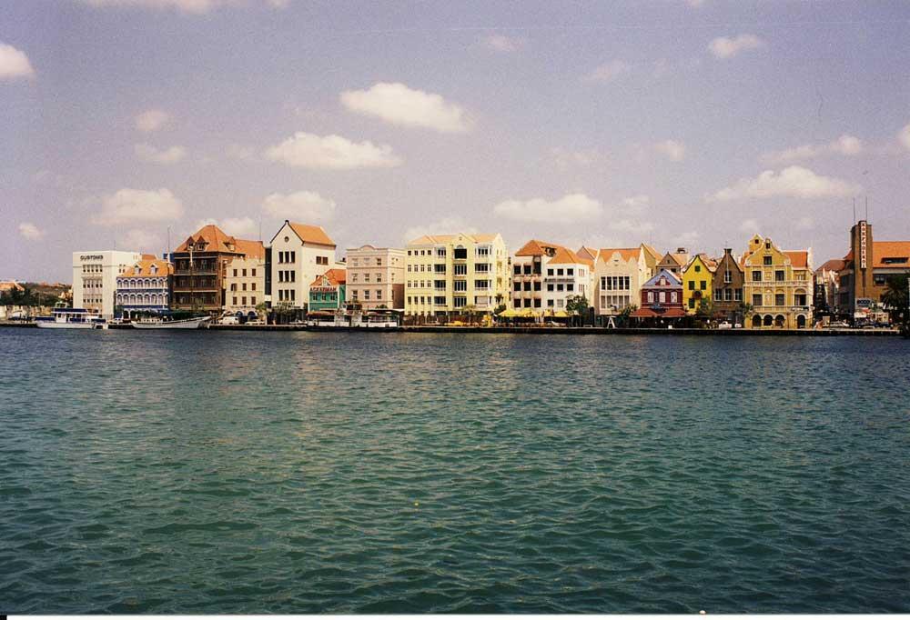 | ||
The colorfully painted buildings of Willemstad. | ||
 | ||||
Click on the dancers for page 5 of our Panama adventure | ||||